UN
48 Rowland Drive
£ 225,000
Description
We don't have a Description for this property.
- Bedrooms
- 2
- Bathrooms
- 0
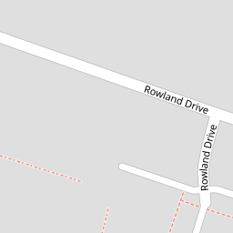

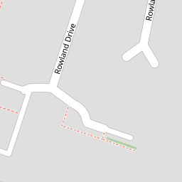

Leaflet © OpenStreetMap contributors
The heatmap indicates the level of crime in the area. The color of the heatmap indicates the crime severity and recency.
Metrics Year-on-Year
- Average area value
- 454,441.00 £Increased by 9.13 %
- Average area rental value
- 2,040.00 £/moIncreased by 11.29 %
- Est rental Yield
- 5.39 %Increased by 2.08 %
- Crime Rate
- 9.00 %Unchanged by 0.00 %
from 416,437.00 £
from 1,833.00 £/mo
from 5.28 %
from 9.00 %
Nearby Schools
| Name | Type | Ofsted | Distance |
|---|---|---|---|
| Briary Primary School | Academy Converter | 0.46 KM | |
| Briary Children'S Centre | Children's Centre Linked Site | 0.77 KM | |
| Herne Bay High School | Academy Converter | Good | 0.84 KM |
| Hampton Primary School | Academy Converter | Good | 0.90 KM |
| Fairlight Glen Independent Special School | Other Independent Special School | Good | 1.89 KM |
Images
Nearby Streets
| Name | Average Price | Average Sqft | Distance |
|---|---|---|---|
| West View Close | £ 0 | 0 | 0.00 KM |
| Wentworth Gardens | £ 525,000 | 0 | 0.00 KM |
| Hawthornden Street | £ 0 | 0 | 0.00 KM |
| Lovell Close | £ 0 | 0 | 0.00 KM |
| Hunter Avenue | £ 625,000 | 0 | 0.00 KM |
Nearby Transport
| Name | NLC | TLC | Distance |
|---|---|---|---|
| Herne Bay | 5174 | HNB | 1.50 KM |
| Chestfield And Swalecliffe | 5200 | CSW | 4.37 KM |
| Sturry | 5029 | STU | 6.50 KM |
| Whitstable | 5196 | WHI | 8.07 KM |
| Canterbury West | 5007 | CBW | 8.82 KM |
Nearby Listings
| Address | Price | Type | Score | Distance |
|---|---|---|---|---|
| Rowland Drive, Herne Bay | £ 165,000 | BUY | 6 / 10 | 0.04 KM |
| Gilchrist Avenue, Herne Bay | £ 310,000 | BUY | 7 / 10 | 0.17 KM |
| The Grove, Herne Bay | £ 335,000 | BUY | 6 / 10 | 0.18 KM |
| The Grove, Herne Bay, CT6 | £ 315,000 | BUY | 8 / 10 | 0.22 KM |
| The Grove, Herne Bay | £ 415,000 | BUY | Unknown | 0.22 KM |
Nearby Properties
| Address | Price | Distance |
|---|---|---|
| 48 Rowland Drive | £ 225,000 | 0.00 KM |
| 57 Rowland Drive | £ 444,000 | 0.00 KM |
| 51 Rowland Drive | £ 240,000 | 0.00 KM |
| 68 Rowland Drive | £ 219,995 | 0.00 KM |
| 58 Rowland Drive | £ 239,995 | 0.01 KM |